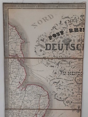
Carl Jugel's Post und Reise Karte von Deutschland und den Nachbarstaaten, bis London, Paris, Montpellier, Florenz, Warschau, Kopenhagen
Features
Author: U. Hendschel, Jos. Back, C. Sauter
Publisher: Carl Jugel
Place of printing: Frankfurt am Main
Year of publication: 1844
Product Condition:
Geographical map clothed and folded in shirt in fair condition: traces of dust and tears without missing parts. Description on the case in German and French on paper labels applied: dust spots and small defects on the corners.
Pages: s.n.
Format: In folio
Dimensions (cm):
Height: 123
Width: 108
Description
Map drawn by U. Hendschel and engraved by Jos. Back and C. Sauter. The geographical map is divided into 48 panels mounted on canvas (123X108 cm), colored borders and a general map of Europe at the bottom right. On the outside, on paper labels applied to the canvas, there is an explanation of the geographical symbols and the rates of postal shipments on horseback in French.
Product availability
Immediate availability
Ready for delivery within 2 working days from ordering the product.


